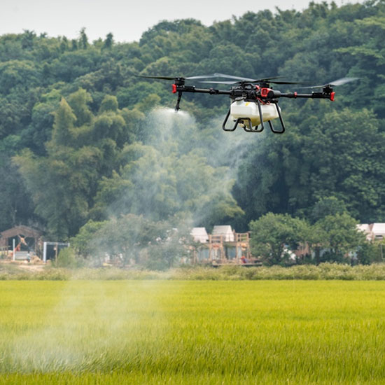
Redefining Ag-Management Across Tattnall County
For the dedicated producers in Reidsville, staying competitive means adopting tools that work as hard as they do. Our drone-based services represent a fundamental evolution in land stewardship, moving away from broad-stroke applications toward Intelligent Input Calibration. We understand that in the diverse landscapes of the Coastal Plain—from the river basins to the sandy uplands—farming is a game of margins and timing. Our objective is to maximize your harvest potential by providing surgical-grade protection for your cotton, peanuts, and specialty crops exactly when the environment demands it, bypassing the physical constraints of heavy ground machinery.
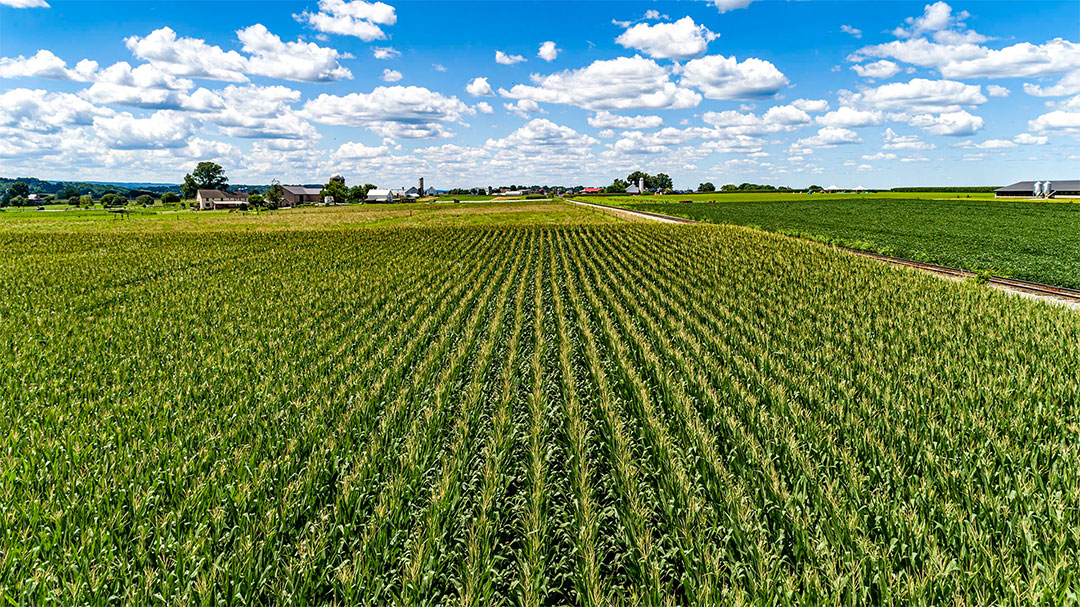
Our agricultural experts are deep-rooted in the regional farming rhythm. We view ourselves as strategic agronomic consultants rather than simple equipment operators, evaluating your specific acreage challenges before a single rotor turns. We solve the "Saturation Dilemma" frequently faced by Tattnall County growers during the unpredictable summer storm cycles. When the soil is far too soft for a traditional spray rig but the window for treatment is closing, our team provides the rapid aerial response required to safeguard your investment. We specialize in the complex, high-stakes applications that others avoid, ensuring that in Reidsville, advanced technology is always backed by real-world grit.
Liquid Application: Engineering Superior Coverage
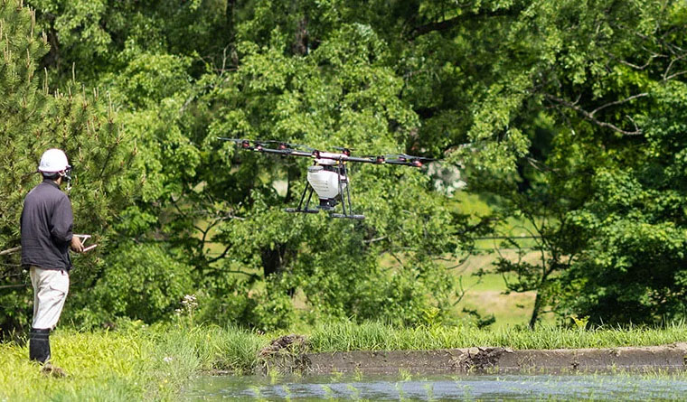
In an era where every ounce of chemical represents a significant investment, South Georgia growers rely on the pinpoint accuracy of our liquid application systems. We have engineered our services to eliminate the waste and inefficiency inherent in legacy spraying methods. Traditional airplanes and ground tractors often struggle with off-target drift and inadequate penetration of the plant's lower canopy, leaving crops exposed to disease. Our fleet utilizes centrifugal atomization, which produces a consistent, optimized droplet size driven deep into the foliage by the powerful downwash of our heavy-lift aircraft.
Fungicide: Preserving Yields in Late-Season Rows
In the humid corridors of Tattnall County, the final stretch of the growing season is often the most volatile. For those managing peanut and cotton rotations, hitting the precise window for White Mold or Leaf Spot control is the difference between profit and loss. As canopies close, ground rigs become a liability, causing soil compaction and mechanical "tractor blight" that damages roots and reduces output. Our drones navigate above the crop, utilizing "vortex-driven" airflow to flip the leaves and coat the entire plant structure, ensuring total protection without ever touching the soil.
Herbicide: Precision Weed Eradication
Protect your bottom line by attacking weeds, not your budget. Blanket broadcast spraying often wastes expensive chemicals on empty dirt or non-target areas, which only accelerates resistance issues. We provide a more intelligent path forward. Using multispectral intelligence, we generate custom prescription maps for localized spot-treatment. Our UAVs focus exclusively on the pressure zones, frequently cutting chemical consumption by nearly a third. This precision is vital near the Ohoopee River and other environmentally sensitive zones in Tattnall County, where minimizing chemical runoff is a priority.
Dry Application: Smart Seeding & Nutrient Delivery
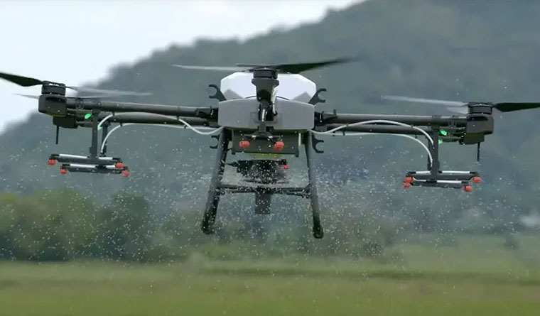
In the sandy loam soils characteristic of the Coastal Plain, nutrient placement is the foundation of crop success. Our dry spreading services offer centimeter-level accuracy for both granular fertilizers and cover crop integration. While traditional spreaders often over-apply or miss the mark, our drones utilize Variable Rate Technology (VRT) to match the application to the soil's specific needs. We boost inputs in nutrient-deficient zones and scale back in high-performing areas, balancing your field’s productivity and optimizing your overhead.
Our aerial seeding capabilities are equally disruptive. Whether you are establishing rye or clover cover crops after the cotton harvest or revitalizing patchy grazing land and pecan orchards, our drones operate seamlessly when the ground is too saturated for heavy equipment. We ensure you hit your planting windows regardless of the weather, providing the flexibility to manage your land dynamically. Every application is documented with an "As-Applied" digital map, giving you a transparent record of coverage for your long-term management strategy.
Specialized Greenhouse Coating Services
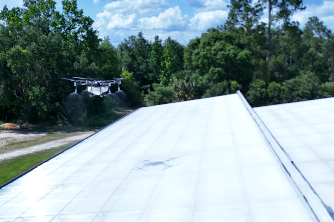
For the nursery and ornamental operations around Reidsville, Georgia’s intense solar radiation is a constant threat to plant health and energy costs. The old-school method of hand-applying shade paint is labor-intensive, hazardous, and often results in splotchy, uneven coverage. We provide a modern, automated alternative. Our team is highly proficient in applying industry-leading ReduSystems products, which are currently setting new standards for greenhouse climate control across the Southeast.
Our drones digitally map your facility’s layout and apply coatings like ReduSol or ReduHeat with flawless uniformity. This autonomous process removes the need for dangerous scaffolding and protects your expensive glass or poly structures from foot-traffic damage. We can treat large-scale greenhouse complexes in a fraction of the time it takes manual crews, ensuring your plants receive optimized light filtration with zero operational downtime.
Advanced Crop Intelligence & Multispectral Imaging

Gain a perspective that goes beyond the visible spectrum. Our Crop Analysis service gives farmers the ability to detect stressors well before they are apparent to the human eye. Once a nutrient deficiency or pest surge is visible from the truck window, your yield has already taken a hit. We deploy MicaSense RedEdge-P sensors on our Wingtra fixed-wing aircraft to capture high-resolution data in wavelengths like near-infrared—a primary indicator of plant vigor and photosynthesis.
This data is converted into intuitive Vegetation Index Maps (NDVI/NDRE), providing a "physical exam" for every acre of your property. These maps allow you to identify irrigation leaks, assess stand counts after emergence, and stop pest outbreaks in their tracks. Your Tattnall County project lead doesn't just hand over a file; they help you translate these images into a tactical management plan, allowing for the data-driven decisions that secure your farm's future.
Regional Proficiency
Row Crop Excellence
Customized spray patterns designed for the dense canopies of South Georgia cotton and peanuts.
Orchard Management
High-resolution multispectral mapping to monitor the health of regional pecan groves.
All-Weather Access
Ensuring your crops get treated when wet soil keeps ground rigs sidelined.
Multi-Pass Discounts
We value the loyalty of our local growers. Ask us about our multi-year and seasonal contract discounts, ensuring stable pricing and priority flight scheduling during the busiest parts of the year.
Request Field Consultation