Superior Hardware as the Foundation of Aerial Insight
At Fair Lifts Unmanned Services, we understand that professional expertise is only as effective as the instruments used to execute it. The Reidsville region—defined by its deep-rooted agricultural heritage and the dense timber stands of the Georgia Coastal Plain—requires technology that can withstand heat, humidity, and high-intensity duty cycles. We don't simply operate drones; we manage a comprehensive, mission-ready technology ecosystem. To ensure our Tattnall County partners always have a competitive edge, we refresh our fleet annually, moving beyond "consumer-grade" toys to provide industrial platforms purpose-built for the thick pine canopies and sprawling row crops of our local economy.
By partnering with Fair Lifts, regional enterprises effectively eliminate capital depreciation and technological risk. The drone industry moves at a lightning pace, where hardware is often eclipsed by newer models in less than two years. Our service model grants you immediate access to a multi-million dollar aviation department without the burden of upfront costs, complex maintenance schedules, or specialized pilot training. Whether you are managing a 10,000-acre timber tract or a high-stakes infrastructure development, we guarantee the use of the most secure, efficient, and precise aerial equipment currently available on the global market.
WingtraOne Gen II: Mastering Large-Scale Mapping
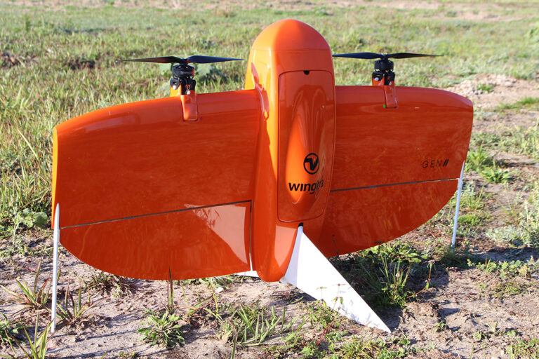
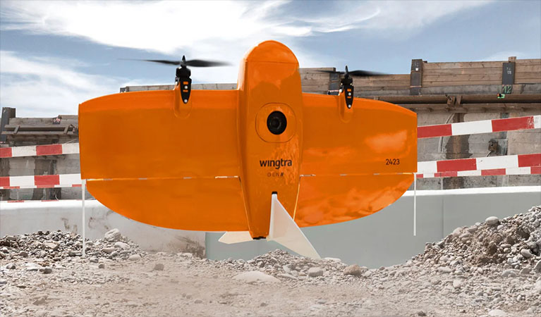
When the mission requires mapping vast stretches of the Coastal Plain, the WingtraOne Gen II is our go-to solution for high-efficiency data collection. In a sprawling area like Tattnall County, speed is vital, but accessibility is often a challenge. The WingtraOne features a sophisticated Vertical Take-Off and Landing (VTOL) design, allowing us to launch from confined spaces like logging trails or narrow field margins without needing a traditional runway. Once airborne, it transitions to fixed-wing flight, allowing us to survey over 700 acres in a single outing—an output ten times greater than standard quadcopters.
This massive coverage area is matched by surgical precision. Integrated with a high-performance Post-Processed Kinematic (PPK) GNSS system and synchronized with our on-site Emlid base stations, the Wingtra provides centimeter-level accuracy. For Reidsville’s surveyors, foresters, and developers, this translates to survey-grade geospatial data delivered in a fraction of the time, resulting in a flawless "digital twin" of any land asset.
XAG P150: Redefining Agricultural Application
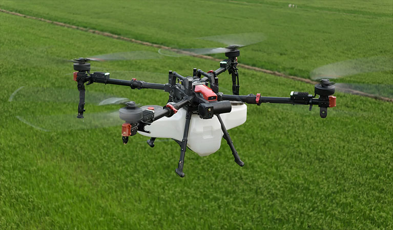
For precision crop protection and environmental management, we utilize the XAG P150—the pinnacle of heavy-lift autonomous application technology. In the intense humidity of South Georgia, the window for effective fungicide or insecticide application is incredibly narrow. The P150 is engineered for the grit of the field, featuring a high-capacity 70L reservoir and advanced centrifugal atomization sprayers. Unlike old-fashioned nozzles that are prone to clogging and uneven drift, our atomization tech ensures a consistent droplet size, maximizing every ounce of chemistry and minimizing environmental runoff.
The technical secret to the P150’s success is the powerful downward air vortex generated by its rotors. As the aircraft glides just above the crop line, this turbulent air "opens up" the plant canopy, flipping the leaves and driving the application deep into the root zone and the underside of the foliage. For Reidsville growers of onions, peanuts, and cotton, this 360-degree saturation is the key to eradicating white mold and stubborn pests. We transform traditional, week-long ground-rig schedules into mere hours of autonomous, precision-targeted aerial application.
| UAS Feature | Benefit to Reidsville Farmers |
|---|---|
| Variable Rate Application | Apply chemicals only where needed based on high-resolution map data, reducing input costs. |
| Zero Soil Compaction | Effective spraying immediately after heavy rains when ground rigs would cause permanent soil damage or get stuck. |
| Multispectral Imaging | Identifying "hidden" crop stress and nutrient deficiencies before they are visible to the naked eye. |
| Swarm Technology | Multiple drones working a single field in coordination to cover large regional acreage with maximum efficiency. |
Blue UAS: Military-Grade Data Integrity
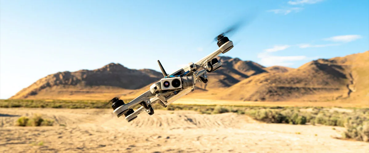
As cybersecurity becomes a primary concern for local government and private industry, the origin and security of your drone technology are paramount. Fair Lifts prioritizes the protection of Tattnall County’s data. Our survey fleet is anchored by Blue UAS Certified aircraft—platforms that have been rigorously vetted by the U.S. Department of Defense. This certification ensures that your geospatial data is handled with the highest standards of encryption and supply chain integrity. Whether we are auditing a municipal utility, a power grid, or a sensitive pipeline, you can rest easy knowing your data is shielded from unauthorized access. We provide a secure alternative to the significant risks posed by unvetted, foreign-made consumer drones.
Actionable Intelligence: Data Processing Excellence
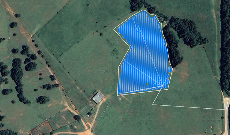
The flight is only the first phase of the solution. At Fair Lifts, the final 30% of our value lies in how we translate raw imagery into business intelligence. Utilizing the PIX4D software ecosystem, we employ PIX4Dmatic for industrial-scale photogrammetry and PIX4Dfields for high-speed agricultural diagnostics. These powerful tools allow our data specialists to convert terabytes of aerial photos into high-fidelity orthomosaics, detailed 3D point clouds, and multispectral plant health maps. We deliver all final outputs in the GIS, CAD, or farm management formats your team already utilizes, ensuring that our aerial insights integrate perfectly into your daily workflow.
Integrated Sensor Technology
MAP61 / RGB61
Ultra-high resolution Sony sensors designed for crystal-clear 2D mapping and hyper-realistic 3D reconstructions.
Riegl miniVUX LiDAR
High-frequency laser scanning that pierces through Georgia’s thick timber canopies to reveal the true topography of the earth.
MicaSense RedEdge-P
Advanced multispectral sensors that provide deep insights into crop stress and vigor across five distinct light bands.
Local Support & Redundancy
Our Reidsville hub maintains a full inventory of replacement components and backup aircraft. If a system requires maintenance, a redundant platform is ready for immediate deployment to keep your project on schedule.
Request Technical Brief